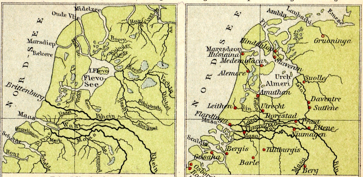
I also think that the names of three areas North of the Rhine are shuffled:
- Trajectum: in this region (there were many more places named Trajectum, which just means 'ford', the closest being Maastricht) is Utrecht, which is in the game region named Frisii. This Utrecht Trajectum was just one of the fortresses of the later Roman limes here.
- Frisii: one certain location where Frisii lived is around Velsen (and North of it), on the coast directly West of current Amsterdam, because there is a narrative about a revolt there, and the siege of the Roman camp there has been found archeologically. That area is in the game called Caninefates.
- Caninefates: lived in the neighbourhood of current the Hague, where the Romans constructed their capital Forum Hadriani. This area is in the game called Trajectum.
http://en.wikipedia.org/wiki/Forum_Hadriani
- Fectio: was a limes fortress just South of Utrecht.
Frisii in Roman times were described as living West of the Chaucii, while Chaucii were described as living from the mouth of the Ems (Amisia) to the East and the South. So the area called Chaucii in the game seems to me to be too far to the West. That area is supposed to be Frisian.
Placing the area Batavii South of the river Mosa is also strange: the core land of the Batavii was North of and including Nijmegen, where the 'Island of the Batavii' was between the river Waal (Vahalis) and the Lower Rhine, that is not depicted on this map, but that ran along Fectio, Trajectum, towards the mouth at Katwijk (Brittenburg in the map in the OP), and maybe further along the Rhine towards Colonia Agrippina.


 right ! the coast had change a lot !


